باختصار
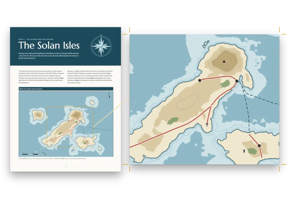
ثلاث صفحات من أطلس مدرسي لبلد متخيَّل. الخرائط رسوم بلا نص، وكل أسمائها مكتوبة في النص، فتغيّر الترجمة الكلمات وتبقى الخرائط كما هي.
ما الذي ستنضده
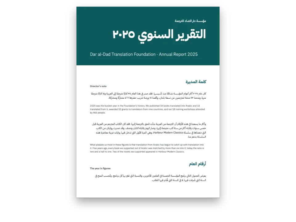
ثلاث لوحات من أطلس مدرسي لفارينيا، وهي بلد اختُرع لهذه الوصفة. تبيّن اللوحة ١ موقعها في قارتها، وتمدّ اللوحة ٢ الخريطة الطبيعية على الصفحتين، من بحر ليرا إلى الحدود مع برونافيا، بألوان الارتفاع، مع ثلاثة أنهار وخط مقطع، وترسم اللوحة ٣ ذلك المقطع عبر سلسلة ألبار. تبدأ كل لوحة بشريط أزرق وتنتهي بمفتاح للخريطة أو بمفردات وببعض الأنشطة للصف. لا تحمل الرسوم حرفًا واحدًا: الأسماء والارتفاعات وأرقام مقياس الرسم، وعددها ٤٣، أسطر ::label في Markdown، توضع عند مراسٍ يحفظها كل مورد. ولهذا تشترك الطبعات الإسبانية والإنجليزية والعربية في الرسوم الثلاثة نفسها، وتُقرأ العربية وتُجلَّد من اليمين.
تجيب هذه الوصفة عن
- كيف أضع أسماء الخريطة من النص، بحيث تغيّر الترجمة الكلمات ولا تمسّ الرسم؟
- كيف أمدّ خريطة واحدة على صفحتين متقابلتين وأُبقي أسماءها مقروءة في طبعة تُقرأ من اليمين إلى اليسار؟
الجواب المختصر
// A label takes the style its anchor names: seas and rivers in italic blue, ranges in spaced
// brown capitals, towns on a white halo. Arabic is neither slanted nor letter-spaced, and
// Naskh and Kufi set small, so the Arabic edition gets the same styles upright, unspaced and
// 15 % larger.
const [SLANT, TRACK, SIZE] = AR ? ['normal', 0, 1.15] : ['italic', 1, 1];
const halo = { color: col('paper'), width: pt(1.4) };
const style = (id, size, color, more) => ({ id, fontFamily: LABEL, fontSize: pt(size * SIZE),
  fontWeight: AR ? 500 : 400, color: col(color), ...more });
const water = (id, size, spacing, more) => style(id, size, 'water', { fontStyle: SLANT,
  textTransform: spacing ? 'uppercase' : 'none', letterSpacing: spacing * TRACK, ...more });
const caps = (id, size, color, spacing, more) => style(id, size, color, {
  fontWeight: AR ? 700 : 600, textTransform: 'uppercase', letterSpacing: spacing * TRACK,
  ...more });
const labelStyles = [
  water('ocean', 9.5, 0.3), water('sea', 7.5, 0.16), water('river', 6.8, 0, { halo }),
  caps('range', 7, 'relief', 0.32, { halo }), caps('region', 6.5, 'muted', 0.24),
  caps('country', 8.5, 'muted', 0.36), caps('nation', 12, 'ink', 0.42),
  style('capital', 7.6, 'ink', { fontWeight: 700, halo }), style('town', 7, 'ink', { halo }),
  style('peak', 6.5, 'ink', { fontWeight: AR ? 700 : 600, halo }), style('island', 6.5, 'ink'),
  style('point', 8.5, 'band', { fontWeight: 700, halo }), style('tick', 6, 'muted'),
];
// An anchor is a point of the picture in fractions of its width and height, with the side of
// the label that stands there, its turn and its style. km(win) reads a point in km off a map.
const km = (win) => (id, x, y, labelStyle, more) => ({ id, x: (x - win.x0) / (win.x1 - win.x0),
  y: (y - win.y0) / (win.y1 - win.y0), style: labelStyle, ...more });
المكونات
- الميزات
- تسميات على الصورةقوالب الصفحتين المتقابلتينالصفحات المركّبةإطارات تكبر داخل مجموعةعيّنات الألوانالنص من اليمين إلى اليساركتب مجلّدة من اليمينالخطوط العربيةالأشكال والجداول بوصفها مواردأنواع موارد مخصّصةإطارات التنبيهالقوائم المرقّمةأنماط الفقراتالنصوص والخطوط والمربعات في تصاميم الصفحةهوامش متناظرةلوحة ألوان دلاليةصفحات على اللوحة (Canvas)
- الخطوط
- Source Sans 3, Source Serif 4, Noto Naskh Arabic, Noto Kufi Arabic (SIL OFL 1.1)
- الأصول
- لا شيء: كل صورة مرسومة بالكود
طريقة التحضير
#1 · المكان نقطة من الرسم
const above = { verticalAlign: 'bottom' }, below = { verticalAlign: 'top' };
const r = km(WIN.relief), l = km(WIN.locator);
const ANCHORS = {
  relief: [
    r('ocean', 172, 157, 'ocean'), r('lira', 20, 52, 'sea', { rotate: -84 }),
    r('gulf', 318, 154, 'sea', { width: 0.07 }), r('nema', 22, 100, 'island', above),
    r('albar-range', 98, 108, 'range', { rotate: -33 }),
    r('gris-range', 308, 96, 'range', { rotate: -86 }),
    r('plateau', 236, 78, 'region'), r('plain', 70, 98, 'region', { width: 0.08 }),
    r('sela', 108, 62, 'river', { rotate: -4 }), r('duna', 121, 136, 'river', { rotate: -62 }),
    r('merel', 281, 92, 'river', { rotate: -47 }), r('ormo', 254, 104, 'river', above),
    ...TOWNS.map(([id, x, y]) => r(id, x, y - 2.6, id === 'almaren' ? 'capital' : 'town', above)),
    ...PEAKS.map(([id, x, y]) => r(`${id}-peak`, x, y + 2.4, 'peak', below)),
    r('ostelia', 300, 9, 'country'), r('brunavia', 390, 112, 'country', { rotate: -90 }),
    r('varenia', 250, 46, 'nation'),
    r('a', PROFILE[0][0], PROFILE[0][1] - 2, 'point', above),
    r('b', PROFILE[1][0], PROFILE[1][1] + 2, 'point', below),
    r('scale-0', SCALE.x, SCALE.y + 3, 'tick', below),
    r('scale-25', SCALE.x + 25, SCALE.y + 3, 'tick', below),
    r('scale-50', SCALE.x + 50, SCALE.y + 3, 'tick', below),
    r('north', NORTH.x, NORTH.y - 8, 'point', above),
  ],
  locator: [
    l('varenia', 205, 80, 'nation'), l('ostelia', 150, -100, 'country'),
    l('brunavia', 560, -120, 'country'), l('lira', 210, -250, 'sea', { rotate: 20 }),
    l('ocean', -180, -40, 'ocean', { width: 0.2 }), l('almaren', 259, 127 + 22, 'capital', below),
  ],
  // The section: fractions of the drawing, whose plot starts 14 mm in and runs 3 to 51 mm down.
  section: (() => {
    const [w, h] = MAP.section, x = (u) => (14 + u * (w - 14)) / w;
    const y = (m) => (h - 7 - m * (h - 10) / PROFILE_TOP) / h;
    return [
      { id: 'a', x: x(0), y: (h - 5.5) / h, style: 'point', ...below },
      { id: 'b', x: x(0.98), y: (h - 5.5) / h, style: 'point', ...below },
      ...[500, 1000, 1500, 2000].map((m) => ({ id: `m${m}`, x: 7 / w, y: y(m), style: 'tick' })),
      { id: 'sela', x: x(0.3), y: y(700), style: 'region' },
      { id: 'crest', x: x(0.47), y: y(2260), style: 'range', ...above },
      { id: 'plain', x: x(0.82), y: y(650), style: 'region' },
    ];
  })(),
};
المرساة نقطة تُعطى بنسب من عرض الصورة وارتفاعها، فتبقى صحيحة مهما كان الحجم الذي يضع فيه الإطار الخريطة، وإذا صغّرت خطوات الملاءمة الخريطة انتقلت أسماؤها معها. تحوّل km() الكيلومترات التي رُسمت بها الخريطة إلى هذه النسب، فتأتي نقطة المدينة واسمها كلاهما من TOWNS ولا يمكن أن يفترقا. وتحفظ المرساة ما يخصّ المكان لا اللغة: نمطه، ودوران اسم النهر أو السلسلة على امتداد مجراه، والجهة من التسمية التي تقف عند النقطة. وتُوسَّط أسماء المدن فوق نقاطها، لأن align: 'start' يعني يسار الاسم الإنجليزي ويمين الاسم العربي.
#2 · ثلاثة ملفات Markdown ومورد واحد
const ALT = t({
  es: {
    locator: 'Mapa de situación: Varenia, en amarillo, entre Ostelia, Brunavia, el mar de Lira '
      + 'y el océano Brumoso.',
    relief: 'Mapa físico de Varenia en tintas de altitud, con la sierra Albar, los montes '
      + 'Grises, los ríos Sela, Duna y Merel y el corte A–B.',
    section: 'Perfil topográfico de A a B: el valle del Sela, la sierra Albar y la llanura '
      + 'costera.',
  },
  en: {
    locator: 'Locator map: Varenia, in yellow, between Ostelia, Brunavia, the Lira Sea and the '
      + 'Misty Ocean.',
    relief: 'Relief map of Varenia in height tints, with the Albar Range, the Grey Hills, the '
      + 'rivers Sela, Duna and Merel and the line of section A–B.',
    section: 'Section from A to B: the Sela valley, the Albar Range and the coastal plain.',
  },
  ar: {
    locator: 'خريطة الموقع: فارينيا باللون الأصفر بين أوستيليا وبرونافيا '
      + 'وبحر ليرا والمحيط الضبابي.',
    relief: 'خريطة طبيعية لفارينيا بألوان الارتفاع، فيها سلسلة ألبار '
      + 'والتلال الرمادية وأنهار سيلا ودونا وميريل وخط المقطع أ–ب.',
    section: 'مقطع تضاريسي من أ إلى ب: وادي سيلا وسلسلة ألبار '
      + 'والسهل الساحلي.',
  },
});
const resources = Object.entries(MAP).map(([id, [w, h]]) => ({ id, typeId: 'map', kind: 'svg',
  createdAt: 0, updatedAt: 0, svg: { fileId: `${id}.svg`, width: w * 10, height: h * 10 },
  altText: ALT[id], anchors: ANCHORS[id] }));
const drawings = { locator: locatorMap, relief: reliefMap, section: profile };
for (const [id, draw] of Object.entries(drawings)) await loadSvg(`${id}.svg`, draw(MAP[id]));
للمورد ملف SVG واحد وقائمة مراسٍ واحدة لكل الطبعات. وتكتب كل طبعة سطر ::label[…]{at="…"} لكل مرساة داخل :::figure{resource="relief" slot="map"}، فيقع ::label[سهل كالفيرا]{at="plain"} حيث يقع ::label[Calvera Plain]{at="plain"}، ويُقسَم على سطرين بحسب width المرساة عند الحاجة. ولا يتغيّر مع الطبعة إلا النص البديل، لأن المورد لا يأخذ كلمات من Markdown. وإذا ترك إصدارٌ مرساةً ذات نمط بلا تسمية ظهر التنبيه anchorUnlabelled، والتسمية التي يسمّي at فيها مرساة غير موجودة لا تُرسم ويظهر لها labelAnchorUnknown.
#3 · لوحة على صفحة ولوحة على صفحتين
const at = (to, edge, x = 0, y = 0) => ({ anchor: { to, edge }, offset: { x: mm(x), y: mm(y) } });
const kicker = { kind: 'text', id: 'unit', content: '{attr.unit}', fontFamily: LABEL,
  fontSize: pt(AR ? 10 : 8.5), fontWeight: AR ? 500 : 600, letterSpacing: pt(1.3 * TRACK),
  textTransform: 'uppercase', color: col('sky'), align: AR ? 'right' : 'left',
  // Decoration stands on the sheet: the kicker goes to the side the page starts reading from.
  placement: at('container', AR ? 'top-right' : 'top-left', 0, -11) };
const band = { kind: 'box', id: 'band', style: { backgroundColor: col('band') },
  placement: { ...at('bleed', 'top-left'), size: { width: 'fill', height: mm(BAND + 3) } } };
const sheet = {
  id: 'sheet', header: false, decoration: { elements: [band, kicker] },
  frames: [
    { name: 'title', takes: 'h1', placement: at('container', 'top-left', 0, -3) },
    { name: 'text', flow: true, columns: 2, columnGap: mm(7),
      placement: at('container', 'top-left', 0, BAND - PAGE.top + 7) },
    { name: 'map' },
    { name: 'key', style: 'key', width: mm(66) },
    { name: 'tasks', style: 'tasks', placement: at('#key', 'right-of', 6) },
  ],
  // A longer text pushes the map and the key down; the map is set smaller before the text is.
  groups: [{ name: 'column', kind: 'stack', frames: ['text', 'map', 'key'], gap: mm(6) }],
};
// The double sheet: one band and one map across both pages, the boxes under the map.
const spread = {
  id: 'spread', spread: true, header: false, decoration: { elements: [band, kicker] },
  frames: [
    { name: 'title', takes: 'h1', width: mm(177), placement: at('container', 'top-left', 0, -3) },
    { name: 'map', crossGutter: true, // the one frame that runs across the spine
      placement: at('container', 'top-left', 0, BAND - PAGE.top + 5) },
    { name: 'text', flow: true, columns: 2, columnGap: mm(7), width: mm(177) },
    { name: 'key', style: 'key', width: mm(72), placement: at('#map', 'below', 213, 6) },
    { name: 'tasks', style: 'tasks', placement: at('#key', 'right-of', 6) },
  ],
  groups: [{ name: 'column', kind: 'stack', frames: ['map', 'text'], gap: mm(6) }],
};
للقالبين الإطارات الخمسة نفسها، فيكون لـ Markdown اللوحة الشكل نفسه على صفحة أو على صفحتين: العنوان، والنص الذي لا يسمّي خانة، والخريطة، ومفتاحها، والأنشطة. وفي اللوحة المزدوجة يجعل spread: true الصفحتين ورقة واحدة عرضها ٣٩٠ مم، ولا يحمل crossGutter إلا إطار الخريطة، فيعبر الكعب ويبقى النص والإطاران الآخران في صفحاتهم. ويؤلّف النص والخريطة والمفتاح مجموعة stack: في اختبار الضغط على منصة الاختبار، حين تطول النصوص كلها بنسبة ٣٠ ٪، تضع الطبعة العربية خريطة الموقع بنسبة ٨٧٫٥ ٪ وتصعد الإطارات تحتها، بلا أي تنبيه.
#4 · لوحة ألوان واحدة للصفحة وألوان الارتفاع والمفتاح
const palette = {
  ink: '#1f2a2e', paper: '#ffffff', muted: '#55646a', rule: '#c9d2d6',
  band: '#1d5f73', // the accent: the head of each sheet, box stripes, list numbers
  sky: '#d4e9f2', // the kicker on the band
  tint: '#eef2ef', // the key's box
  water: '#22597f', river: '#2c6e9b', sea: '#d4e9f2', deep: '#a9cfe0', // names and lines of water
  low: '#b5d39b', hill: '#dfe3a2', upland: '#ecd08f', mount: '#d4a46c', peak: '#a8754d',
  relief: '#6e4527', // the names of ranges and the line of the section
  land: '#ebe6da', country: '#f2c46b', border: '#8a3b52', // the locator map
};
// col(id) links a colour to its palette entry; the drawings read the same hex from `palette`.
const col = (id) => ({ hex: palette[id], model: 'hex', paletteId: id });
const colorPalette = Object.entries({ ...palette, 'main-color': palette.band }) // the defaults' id
  .map(([id, hex]) => ({ id, name: id, value: { hex, model: 'hex' } }));
ألوان الارتفاع الخمسة مدخلات في لوحة الألوان. يملأ الرسم طبقاته بـ palette.low حتى palette.peak، ويكتب مفتاح اللوحة ٢ :swatch{color="low"} بالمعرّفات نفسها، فيغيّر لون ست عشري جديد الخريطة ومفتاحها معًا. ولأسماء المياه في water تباين ٦:١ على البحر الضحل و٤٫٥:١ على العميق، وللعنوان الأبيض تباين ٧٫٢:١ على band.
#5 · الطبعة العربية
الشيفرة في الجواب المختصر أعلاه. يجعل locale: 'ar' النص من اليمين إلى اليسار ويجلّد الكتاب من اليمين، فتبدأ الصفحتان المتقابلتان بالصفحة اليمنى، وتتبع الإطارات منطقة المحتوى المعكوسة: العنوان والنص على اليمين، والمفتاح يمين الأنشطة. ولا تُعكس الخرائط، فيقف كل اسم عربي حيث رُسم مكانه. وتفقد أنماط التسميات في العربية الخط المائل والتباعد بين الحروف وتكبر بنسبة ١٥ ٪، لأن الكوفي يأتي صغيرًا. وتبقى الزخرفة وأرقام الصفحات مثبتة على الورقة، فينتقل العنوان الصغير إلى أعلى اليمين ويتبادل رقما الصفحتين جهتيهما.
الوصفة كاملة
// ═══ Postext Cookbook · Nº 157 · A school atlas labelled from the Markdown ═══════ // https://postext.dev/en/cookbook/school-atlas-labelled-maps // Code: MIT · Text: original (CC BY 4.0) · Maps: drawn in code from seed 2026 (CC BY 4.0) // Fonts: Source Sans 3, Source Serif 4, Noto Naskh and Kufi Arabic (OFL) · Needs postext ≥ 1.38.0 // // Three pages of a school atlas of Varenia, an invented country: a locator map, the relief map // across a double page and a section through the mountains. The maps are drawn without a letter. // Every name on them is a ::label in content.<lang>.md, standing at an anchor of the resource, // so the Spanish, English and Arabic editions share the same drawings and the same anchors. import { buildDocument, withLoadedFonts, renderPageToCanvas, registerResourceImage, } from 'https://esm.sh/postext'; const LANG = 'ar'; // @lang: the language of the sample document ('es' | 'en' | 'ar') const RECIPE = 'school-atlas-labelled-maps'; // ─── 1 · Design ───────────────────────────────────────────────────────────── // #region palette: the page's colours and the maps' tints, one object for both const palette = { ink: '#1f2a2e', paper: '#ffffff', muted: '#55646a', rule: '#c9d2d6', band: '#1d5f73', // the accent: the head of each sheet, box stripes, list numbers sky: '#d4e9f2', // the kicker on the band tint: '#eef2ef', // the key's box water: '#22597f', river: '#2c6e9b', sea: '#d4e9f2', deep: '#a9cfe0', // names and lines of water low: '#b5d39b', hill: '#dfe3a2', upland: '#ecd08f', mount: '#d4a46c', peak: '#a8754d', relief: '#6e4527', // the names of ranges and the line of the section land: '#ebe6da', country: '#f2c46b', border: '#8a3b52', // the locator map }; // col(id) links a colour to its palette entry; the drawings read the same hex from `palette`. const col = (id) => ({ hex: palette[id], model: 'hex', paletteId: id }); const colorPalette = Object.entries({ ...palette, 'main-color': palette.band }) // the defaults' id .map(([id, hex]) => ({ id, name: id, value: { hex, model: 'hex' } })); // #endregion const AR = LANG === 'ar'; // Three voices per script: a text face, a display face and the face of the map labels. const [TEXT, DISPLAY, LABEL] = AR ? ['Noto Naskh Arabic', 'Noto Kufi Arabic', 'Noto Kufi Arabic'] : ['Source Sans 3', 'Source Serif 4', 'Source Sans 3']; const PAGE = { w: 210, h: 280, top: 22, bottom: 20, inner: 18, outer: 15 }; // mm, mirrored const BAND = 44; // mm from the trim to the foot of the band at the head of a sheet // #region answer: label styles in the config, label fields on the anchors of a resource // A label takes the style its anchor names: seas and rivers in italic blue, ranges in spaced // brown capitals, towns on a white halo. Arabic is neither slanted nor letter-spaced, and // Naskh and Kufi set small, so the Arabic edition gets the same styles upright, unspaced and // 15 % larger. const [SLANT, TRACK, SIZE] = AR ? ['normal', 0, 1.15] : ['italic', 1, 1]; const halo = { color: col('paper'), width: pt(1.4) }; const style = (id, size, color, more) => ({ id, fontFamily: LABEL, fontSize: pt(size * SIZE), fontWeight: AR ? 500 : 400, color: col(color), ...more }); const water = (id, size, spacing, more) => style(id, size, 'water', { fontStyle: SLANT, textTransform: spacing ? 'uppercase' : 'none', letterSpacing: spacing * TRACK, ...more }); const caps = (id, size, color, spacing, more) => style(id, size, color, { fontWeight: AR ? 700 : 600, textTransform: 'uppercase', letterSpacing: spacing * TRACK, ...more }); const labelStyles = [ water('ocean', 9.5, 0.3), water('sea', 7.5, 0.16), water('river', 6.8, 0, { halo }), caps('range', 7, 'relief', 0.32, { halo }), caps('region', 6.5, 'muted', 0.24), caps('country', 8.5, 'muted', 0.36), caps('nation', 12, 'ink', 0.42), style('capital', 7.6, 'ink', { fontWeight: 700, halo }), style('town', 7, 'ink', { halo }), style('peak', 6.5, 'ink', { fontWeight: AR ? 700 : 600, halo }), style('island', 6.5, 'ink'), style('point', 8.5, 'band', { fontWeight: 700, halo }), style('tick', 6, 'muted'), ]; // An anchor is a point of the picture in fractions of its width and height, with the side of // the label that stands there, its turn and its style. km(win) reads a point in km off a map. const km = (win) => (id, x, y, labelStyle, more) => ({ id, x: (x - win.x0) / (win.x1 - win.x0), y: (y - win.y0) / (win.y1 - win.y0), style: labelStyle, ...more }); // #endregion // #region templates: a sheet and a double sheet, each a band, a text, a map and two boxes const at = (to, edge, x = 0, y = 0) => ({ anchor: { to, edge }, offset: { x: mm(x), y: mm(y) } }); const kicker = { kind: 'text', id: 'unit', content: '{attr.unit}', fontFamily: LABEL, fontSize: pt(AR ? 10 : 8.5), fontWeight: AR ? 500 : 600, letterSpacing: pt(1.3 * TRACK), textTransform: 'uppercase', color: col('sky'), align: AR ? 'right' : 'left', // Decoration stands on the sheet: the kicker goes to the side the page starts reading from. placement: at('container', AR ? 'top-right' : 'top-left', 0, -11) }; const band = { kind: 'box', id: 'band', style: { backgroundColor: col('band') }, placement: { ...at('bleed', 'top-left'), size: { width: 'fill', height: mm(BAND + 3) } } }; const sheet = { id: 'sheet', header: false, decoration: { elements: [band, kicker] }, frames: [ { name: 'title', takes: 'h1', placement: at('container', 'top-left', 0, -3) }, { name: 'text', flow: true, columns: 2, columnGap: mm(7), placement: at('container', 'top-left', 0, BAND - PAGE.top + 7) }, { name: 'map' }, { name: 'key', style: 'key', width: mm(66) }, { name: 'tasks', style: 'tasks', placement: at('#key', 'right-of', 6) }, ], // A longer text pushes the map and the key down; the map is set smaller before the text is. groups: [{ name: 'column', kind: 'stack', frames: ['text', 'map', 'key'], gap: mm(6) }], }; // The double sheet: one band and one map across both pages, the boxes under the map. const spread = { id: 'spread', spread: true, header: false, decoration: { elements: [band, kicker] }, frames: [ { name: 'title', takes: 'h1', width: mm(177), placement: at('container', 'top-left', 0, -3) }, { name: 'map', crossGutter: true, // the one frame that runs across the spine placement: at('container', 'top-left', 0, BAND - PAGE.top + 5) }, { name: 'text', flow: true, columns: 2, columnGap: mm(7), width: mm(177) }, { name: 'key', style: 'key', width: mm(72), placement: at('#map', 'below', 213, 6) }, { name: 'tasks', style: 'tasks', placement: at('#key', 'right-of', 6) }, ], groups: [{ name: 'column', kind: 'stack', frames: ['map', 'text'], gap: mm(6) }], }; // #endregion // Boxes: the key on a pale blue tint, the tasks behind a stripe in the band's blue. const boxText = { fontFamily: TEXT, fontSize: pt(AR ? 10.5 : 8.6), lineHeight: pt(AR ? 17 : 12), color: col('ink'), boldColor: col('ink'), italicColor: col('ink'), firstLineIndent: pt(0), textAlign: 'start' }; // ragged in every script: a box's short lines are never stretched const boxTitle = { fontFamily: LABEL, fontSize: pt(AR ? 9.5 : 8), fontWeight: 700, letterSpacing: pt(1.2 * TRACK), textTransform: 'uppercase', color: col('band') }; const calloutStyles = [ { id: 'key', backgroundEnabled: true, background: col('tint'), border: { enabled: false }, padding: { top: mm(3), right: mm(3.5), bottom: mm(3), left: mm(3.5) }, titleStyle: boxTitle, body: boxText }, { id: 'tasks', backgroundEnabled: false, border: { enabled: false }, stripe: { enabled: true, side: 'top', width: pt(2.5), color: col('band') }, padding: { top: mm(2.5), right: mm(0), bottom: mm(0), left: mm(0) }, titleStyle: boxTitle, body: boxText }, ]; // The folio and the atlas's name at the foot, on the outer side. An Arabic book is bound on the // right, so its rectos (odd pages) stand left of the spine and their outer edge is the left. const foot = (parity) => { const left = (parity === 'even') !== AR; const text = (id, content, x, extra) => ({ kind: 'text', id: `${id}-${parity}`, content, parity, fontFamily: LABEL, fontSize: pt(AR ? 9 : 8), fontWeight: AR ? 500 : 400, color: col('muted'), align: left ? 'left' : 'right', ...extra, placement: at('page', left ? 'bottom-left' : 'bottom-right', left ? x : -x, -11) }); return [text('folio', '{pageNumber}', PAGE.outer, { fontWeight: 700, color: col('band') }), text('title', '{title}', PAGE.outer + 8)]; }; const footer = { elements: [...foot('even'), ...foot('odd')] }; const config = { locale: t({ es: 'es', en: 'en-gb', ar: 'ar' }), // written out: Arabic sets the page right to left colorPalette, labelStyles, calloutStyles, footer, header: { elements: [] }, pageTemplates: [sheet, spread], // The maps are a type of their own with no caption: their titles are the pages' headings. resourceTypes: [{ id: 'map', name: t({ es: 'Mapa', en: 'Map', ar: 'خريطة' }), shortLabel: '', numberingTemplate: '', resetOn: 'never', counterFormat: 'decimal', captionPrefix: '', defaultPlacement: { position: 'here' } }], page: { sizePreset: 'custom', width: mm(PAGE.w), height: mm(PAGE.h), dpi: 150, margins: { top: mm(PAGE.top), bottom: mm(PAGE.bottom), left: mm(PAGE.inner), right: mm(PAGE.outer), mirror: true } }, layout: { layoutType: 'single' }, bodyText: AR ? { fontFamily: TEXT, fontSize: pt(12), lineHeight: pt(20), color: col('ink'), boldColor: col('ink'), italicColor: col('ink'), referenceColor: col('ink'), textAlign: 'justify', firstLineIndent: em(1), hyphenation: { enabled: false } } : { fontFamily: TEXT, fontSize: pt(10), lineHeight: pt(14), color: col('ink'), boldColor: col('ink'), italicColor: col('ink'), referenceColor: col('ink'), textAlign: 'left', firstLineIndent: mm(0), paragraphSpacing: true, hyphenation: { enabled: true }, optimalLineBreaking: true, avoidWidows: true, avoidOrphans: true, avoidRunts: true }, headings: { fontFamily: DISPLAY, fontWeight: 700, color: col('paper'), levels: [ { level: 1, fontSize: pt(AR ? 24 : 26), lineHeight: pt(AR ? 34 : 30), marginTop: pt(0), marginBottom: pt(0), breakBefore: { enabled: false } }, ] }, orderedLists: { numberFormat: 'arabic', color: col('band'), fontWeight: 700, marginTop: pt(0), marginBottom: pt(0) }, paragraphStyles: [{ id: 'colophon', fontFamily: TEXT, fontSize: pt(AR ? 8.5 : 7.5), lineHeight: pt(AR ? 14 : 10), color: col('muted'), textAlign: 'start', firstLineIndent: pt(0) }], }; // ─── 2 · Content ──────────────────────────────────────────────────────────── const markdown = String.raw`---نموذج Markdown · أسطر: 128 · content.ar.md
title: "أطلس فارينيا المدرسي" --- ::::page{template="sheet" unit="اللوحة ١ · الموقع"} # فارينيا على الخريطة فارينيا بلدٌ في جنوب القارة، تحدّها أوستيليا من الشمال وبرونافيا من الشرق. يطلّ ساحلها الغربي على بحر ليرا، وساحلها الجنوبي على المحيط الضبابي الذي يتوغّل في البرّ عند خليج سورا. تبلغ مساحتها نحو ٤٠ ألف كيلومتر مربع، ويسكنها قرابة أربعة ملايين نسمة. تقع العاصمة ألمارين على نهر ميريل، على بُعد كيلومترات قليلة من بحيرة أورمو. ويعيش نحو نصف السكان على الساحل، في مدن ذات موانئ مثل كالفيرا وتيسا وميناء سورا. تبيّن هذه الخريطة موقع فارينيا، وتعرض الصفحتان التاليتان تضاريسها وأنهارها. :::figure{resource="locator" slot="map"} ::label[فارينيا]{at="varenia"} ::label[أوستيليا]{at="ostelia"} ::label[برونافيا]{at="brunavia"} ::label[بحر ليرا]{at="lira"} ::label[المحيط الضبابي]{at="ocean"} ::label[ألمارين]{at="almaren"} ::: :::frame{slot="key" title="مفتاح الخريطة"} :swatch{color="country"} فارينيا \\ :swatch{color="land"} بلدان أخرى \\ :swatch{color="sea"} بحر ومحيط \\ :swatch{color="border"} حدود \\ :swatch{color="ink"} العاصمة ::: :::frame{slot="tasks" title="أنشطة"} 1. ما البلدان التي تحدّ فارينيا؟ وفي أيّ جهة يقع كلّ منها؟ 2. على أيّ بحر يطلّ الساحل الغربي؟ وعلى أيّ محيط يطلّ الساحل الجنوبي؟ 3. ابحث عن العاصمة. هل تقع على الساحل أم في الداخل؟ ::: :::: ::::page{template="spread" spread unit="اللوحة ٢ · التضاريس والأنهار"} # تضاريس فارينيا وأنهارها تعبر سلسلة ألبار غربَ البلاد من الجنوب الغربي إلى الشمال الشرقي، وهي أعلى سلاسل فارينيا: ترتفع قمة ألبار إلى ٢٥٦٥ مترًا. وفي الشرق، قرب الحدود مع برونافيا، تقوم التلال الرمادية، وهي أخفض وأكثر استدارة. وبين السلسلتين تمتدّ هضبة أورمو على ارتفاع ٦٠٠ متر تقريبًا. تنبع الأنهار من الجبال وتنحدر إلى البحر. يجري نهر سيلا نحو الغرب ويصبّ عند كالفيرا، وينحدر نهر دونا القصير السريع نحو الجنوب، أمّا نهر ميريل، وهو أطولها، فيعبر بحيرة أورمو ويصبّ في خليج سورا. ويدلّ الخط أ–ب على المقطع المرسوم في اللوحة ٣. :::figure{resource="relief" slot="map"} ::label[المحيط الضبابي]{at="ocean"} ::label[بحر ليرا]{at="lira"} ::label[خليج سورا]{at="gulf"} ::label[جزيرة نيما]{at="nema"} ::label[سلسلة ألبار]{at="albar-range"} ::label[التلال الرمادية]{at="gris-range"} ::label[هضبة أورمو]{at="plateau"} ::label[سهل كالفيرا]{at="plain"} ::label[نهر سيلا]{at="sela"} ::label[نهر دونا]{at="duna"} ::label[نهر ميريل]{at="merel"} ::label[بحيرة أورمو]{at="ormo"} ::label[ألمارين]{at="almaren"} ::label[كالفيرا]{at="calvera"} ::label[تيسا]{at="tessa"} ::label[ميناء سورا]{at="sora"} ::label[برينا]{at="brena"} ::label[قمة ألبار \\ ٢٥٦٥ م]{at="albar-peak"} ::label[القمة الرمادية \\ ١٢٧٤ م]{at="gris-peak"} ::label[أوستيليا]{at="ostelia"} ::label[برونافيا]{at="brunavia"} ::label[فارينيا]{at="varenia"} ::label[أ]{at="a"} ::label[ب]{at="b"} ::label[٠]{at="scale-0"} ::label[٢٥]{at="scale-25"} ::label[٥٠ كم]{at="scale-50"} ::label[ش]{at="north"} ::: :::frame{slot="key" title="الارتفاع"} :swatch{color="peak"} أكثر من ١٨٠٠ م \\ :swatch{color="mount"} من ١٠٠٠ إلى ١٨٠٠ م \\ :swatch{color="upland"} من ٥٠٠ إلى ١٠٠٠ م \\ :swatch{color="hill"} من ٢٠٠ إلى ٥٠٠ م \\ :swatch{color="low"} من ٠ إلى ٢٠٠ م \\ :swatch{color="sea"} البحر ::: :::frame{slot="tasks" title="أنشطة"} 1. أيّ السلسلتين أعلى: سلسلة ألبار أم التلال الرمادية؟ وكيف تعرف ذلك من الألوان؟ 2. تتبّع نهر ميريل من منبعه. بأيّ بحيرة يمرّ؟ وأين يصبّ؟ 3. استعمل مقياس الرسم لتقيس المسافة المستقيمة بين كالفيرا وألمارين. ::: :::: ::::page{template="sheet" unit="اللوحة ٣ · مقطع تضاريسي"} # مقطع في سلسلة ألبار يبيّن المقطع التضاريسي شكل الأرض كما لو قطعناها على طول خط. ويتبع هذا المقطع الخط أ–ب في الخريطة الطبيعية: يبدأ في تلال الشمال، وينزل إلى وادي سيلا، ثم يصعد سلسلة ألبار إلى أكثر من ٢١٠٠ متر، وينتهي في سهل الساحل الجنوبي. يبلغ طول الخط أ–ب ١٢٦ كيلومترًا. ولكي تظهر الجبال بوضوح ضُخِّم المقياس الرأسي نحو أربع عشرة مرة، فتبدو المنحدرات في الرسم أشدّ انحدارًا مما هي في الواقع. :::paragraphs{style="colophon"} فارينيا وخرائطها متخيَّلة، رُسمت لهذا الأطلس. النص والخرائط: CC BY 4.0. الخطوط: Noto Naskh Arabic وNoto Kufi Arabic (SIL OFL). ::: :::figure{resource="section" slot="map"} ::label[أ]{at="a"} ::label[ب]{at="b"} ::label[٥٠٠ م]{at="m500"} ::label[١٠٠٠ م]{at="m1000"} ::label[١٥٠٠ م]{at="m1500"} ::label[٢٠٠٠ م]{at="m2000"} ::label[وادي سيلا]{at="sela"} ::label[سلسلة ألبار]{at="crest"} ::label[السهل الساحلي]{at="plain"} ::: :::frame{slot="key" title="مفردات"} **السلسلة الجبلية:** جبال متّصلة تصطفّ قممها في خط واحد. **الهضبة:** أرض مرتفعة مستوية السطح، يزيد ارتفاعها على ٤٠٠ متر فوق سطح البحر. **الوادي:** أرض منخفضة بين الجبال أو التلال، يجري فيها نهر في الغالب. **السهل:** أرض منخفضة شبه مستوية، مثل الأرض الممتدة على الساحل الجنوبي. ::: :::frame{slot="tasks" title="أنشطة"} 1. ما الارتفاع التقريبي لأعلى نقطة في سلسلة ألبار على هذا المقطع؟ 2. لماذا يقع وادي سيلا أخفض من الأراضي المحيطة به؟ 3. ارسم في دفترك مقطعًا لخط يمتدّ من كالفيرا إلى ألمارين. 4. ما لون الأرض عند النقطة أ وعند النقطة ب في الخريطة الطبيعية؟ هل يوافق ذلك المقطع؟ ::: ::::`; // content.<lang>.md: every word of the pages, maps included // #region art: one seeded height field, drawn as the locator map, the relief map and a profile // Varenia is invented: a coast, two ranges and three rivers laid out in km (x east, y south), // warped by value noise, cut into height bands by marching squares. The drawings carry no // letters: every name, number and the N of the arrow is a ::label of the Markdown, standing at // an anchor of ANCHORS. No markers, filters or masks. const SEED = 2026; // the seed every coast and height is drawn from const MAP = { locator: [177, 118], relief: [390, 160], section: [177, 100] }; // drawings, in mm const WIN = { // the km each map shows: x east, y south relief: { x0: 0, x1: 400, y0: 0, y1: 400 * MAP.relief[1] / MAP.relief[0] }, locator: { x0: -330, x1: 770, y0: -520, y1: -520 + 1100 * MAP.locator[1] / MAP.locator[0] }, }; const TOWNS = [['almaren', 259, 127, 'capital'], ['calvera', 53, 66], ['tessa', 108, 142], ['sora', 296, 132], ['brena', 346, 92]]; const PEAKS = [['albar', 170, 63], ['gris', 325, 55]]; const PROFILE = [[92, 32], [166, 134]]; // A and B, the ends of the section const PROFILE_TOP = 2600; // m at the head of the section const SCALE = { x: 8, y: 157 }, NORTH = { x: 22, y: 140 }; // the scale bar and the arrow function mulberry32(seed) { // a seeded PRNG: never Math.random() in a recipe return () => { seed = (seed + 0x6d2b79f5) | 0; let r = Math.imul(seed ^ (seed >>> 15), 1 | seed); r = (r + Math.imul(r ^ (r >>> 7), 61 | r)) ^ r; return ((r ^ (r >>> 14)) >>> 0) / 4294967296; }; } const rand = mulberry32(SEED); const LATTICE = Array.from({ length: 64 * 64 }, () => rand() * 2 - 1); const ease = (u) => u * u * (3 - 2 * u); function noise(x, y) { // value noise in −1…1 on a 64 × 64 lattice that wraps const [i, j] = [Math.floor(x), Math.floor(y)], [u, v] = [ease(x - i), ease(y - j)]; const at = (a, b) => LATTICE[((b & 63) << 6) | (a & 63)]; const top = at(i, j) + (at(i + 1, j) - at(i, j)) * u; const foot = at(i, j + 1) + (at(i + 1, j + 1) - at(i, j + 1)) * u; return top + (foot - top) * v; } const fbm = (x, y) => [1, 2, 4, 8].reduce((s, f) => s + noise(f * x, f * y) / (2 * f), 0); // Polylines in km. A range is a crest line and its height; a river runs from source to mouth. const RANGES = [ { crest: [[62, 132], [96, 108], [128, 88], [158, 70], [184, 56]], height: 2150, width: 15 }, { crest: [[318, 30], [326, 62], [322, 96], [312, 124]], height: 1050, width: 13 }, ]; const RIVERS = { sela: [[156, 78], [138, 70], [118, 66], [97, 68], [78, 62], [60, 64], [40, 62]], duna: [[126, 112], [120, 126], [112, 138], [106, 150], [101, 168]], merel: [[306, 44], [296, 62], [281, 80], [266, 96], [256, 110], [258, 124], [268, 138], [282, 150], [292, 168]], }; const LAKE = { x: 254, y: 111, rx: 7.5, ry: 4.8 }; const BORDERS = [ // Varenia and Ostelia; Varenia and Brunavia; Ostelia and Brunavia [[30, 12], [80, 6], [128, 10], [172, 18], [214, 12], [256, 24], [298, 22], [338, 34], [376, 44]], [[376, 44], [372, 76], [380, 104], [368, 132], [374, 156], [370, 190]], [[376, 44], [392, -40], [384, -170], [420, -330], [404, -520]], ]; function segDist(x, y, pts) { // the distance from (x, y) to a polyline, km let best = Infinity; for (let i = 1; i < pts.length; i++) { const [[ax, ay], [bx, by]] = [pts[i - 1], pts[i]], [dx, dy] = [bx - ax, by - ay]; const u = Math.max(0, Math.min(1, ((x - ax) * dx + (y - ay) * dy) / (dx * dx + dy * dy))); best = Math.min(best, Math.hypot(ax + u * dx - x, ay + u * dy - y)); } return best; } function landness(x, y) { // km inland from the coast; negative out at sea // Far from Varenia (the window of the relief map) the coast takes larger turns. const far = Math.min(1, Math.hypot(Math.max(0, -x, x - 400), Math.max(0, -y, y - 175)) / 160); const west = x - (50 + 26 * fbm(y / 46, 3.1) + 9 * fbm(y / 11, 8.2) + far * (240 * fbm(y / 520, 7.7) - 0.45 * Math.max(0, -y - 80))); const south = 146 + 16 * fbm(x / 52, 1.3) + 6 * fbm(x / 13, 2.6) + far * (200 * fbm(x / 480, 4.4) + 0.8 * Math.max(0, x - 430)) - y; const gulf = Math.hypot((x - 312) / 1.3, y - 166) - 38 - 6 * fbm(x / 12, y / 12); const [lu, lv] = [(x - 200) * 0.94 + (y + 240) * 0.34, (y + 240) * 0.94 - (x - 200) * 0.34]; const lira = Math.hypot(lu / 2.6, lv) - 92 - 30 * fbm(x / 70, y / 70); // an inland sea, north const cape = 1 - Math.hypot((x - 90) / 22, (y - 148) / 17) + 0.3 * fbm(x / 8, y / 8); const nema = 8 - Math.hypot(x - 22, (y - 110) * 1.4) + 3 * fbm(x / 6, y / 6); return Math.max(Math.min(west, Math.max(south, cape * 12), gulf, lira), nema); } function elevation(x, y) { // metres; below 0 is sea, NaN is the lake const wx = x + 6 * fbm(x / 24, y / 24 + 5), wy = y + 6 * fbm(x / 24 + 9, y / 24); const coast = landness(wx, wy); if (coast < 0) return Math.max(-900, coast * 28); if (((x - LAKE.x) / LAKE.rx) ** 2 + ((y - LAKE.y) / LAKE.ry) ** 2 < 1) return NaN; let e = 20 + Math.min(coast, 45) * 4 + 430 * Math.exp(-(((x - 236) / 58) ** 2 + ((y - 88) / 34) ** 2)); for (const { crest, height, width } of RANGES) { const ridge = Math.exp(-((segDist(wx, wy, crest) / width) ** 2)); e += height * ridge * (0.75 + 0.5 * fbm(x / 9, y / 9)); } for (const river of Object.values(RIVERS)) { e -= 420 * Math.exp(-((segDist(x, y, river) / 6) ** 2)); } e += 170 * fbm(x / 7, y / 7); return Math.max(e, 2 + coast * 0.6); } const EDGES = { 1: ['B', 'L'], 2: ['R', 'B'], 3: ['R', 'L'], 4: ['T', 'R'], 6: ['T', 'B'], 7: ['T', 'L'], 8: ['L', 'T'], 9: ['B', 'T'], 11: ['R', 'T'], 12: ['L', 'R'], 13: ['B', 'R'], 14: ['L', 'B'], 5: ['T', 'L', 'B', 'R', 'T', 'R', 'B', 'L'], // saddles: joined, then apart 10: ['R', 'T', 'L', 'B', 'L', 'T', 'R', 'B'] }; function contours(grid, nx, ny, level) { // marching squares: closed loops above `level` const v = (i, j) => (i >= 0 && j >= 0 && i < nx && j < ny ? grid[j * nx + i] : -1e9); const at = new Map(), next = new Map(); const edge = (i, j, side) => { // T, B, L or R of cell (i, j), as a key shared by neighbours const [a, b, horizontal] = { T: [i, j, 1], B: [i, j + 1, 1], L: [i, j, 0], R: [i + 1, j, 0] }[side]; const key = `${horizontal ? 'h' : 'v'}${a},${b}`; if (!at.has(key)) { const [p, q] = horizontal ? [v(a, b), v(a + 1, b)] : [v(a, b), v(a, b + 1)]; const u = Math.max(0, Math.min(1, (level - p) / (q - p))); at.set(key, horizontal ? [a + u, b] : [a, b + u]); } return key; }; for (let j = -1; j < ny; j++) { for (let i = -1; i < nx; i++) { const corners = [v(i, j), v(i + 1, j), v(i + 1, j + 1), v(i, j + 1)]; const index = corners.reduce((n, c) => n * 2 + (c > level), 0); let sides = EDGES[index]; if (!sides) continue; const high = corners.reduce((a, b) => a + b) / 4 > level; // a saddle: which way it joins if (sides.length > 4) sides = high ? sides.slice(0, 4) : sides.slice(4); for (let k = 0; k < sides.length; k += 2) { next.set(edge(i, j, sides[k]), edge(i, j, sides[k + 1])); } } } const loops = []; for (const start of [...next.keys()]) { const loop = []; for (let k = start; next.has(k);) { loop.push(at.get(k)); const n = next.get(k); next.delete(k); k = n; } if (loop.length > 4) loops.push(loop); } return loops; } const chaikin = (loop) => loop.flatMap((p, i) => { const q = loop[(i + 1) % loop.length]; return [[0.75 * p[0] + 0.25 * q[0], 0.75 * p[1] + 0.25 * q[1]], [0.25 * p[0] + 0.75 * q[0], 0.25 * p[1] + 0.75 * q[1]]]; }); const r1 = (n) => Math.round(n * 10) / 10; // The window win = { x0, x1, y0, y1 } in km, drawn w × h units; field(x, y) gives the value. function raster(win, w, h, field, cell = 1) { const [nx, ny] = [Math.ceil(w / cell) + 1, Math.ceil(h / cell) + 1]; const grid = new Float32Array(nx * ny); for (let j = 0; j < ny; j++) { for (let i = 0; i < nx; i++) { grid[j * nx + i] = field(win.x0 + i * (win.x1 - win.x0) / (nx - 1), win.y0 + j * (win.y1 - win.y0) / (ny - 1)); } } const k = w / (win.x1 - win.x0); // units per km const X = (x) => r1((x - win.x0) * k), Y = (y) => r1((y - win.y0) * k); const above = (level, g = grid) => contours(g, nx, ny, level).map((loop) => { const p = chaikin(chaikin(loop)); return `M${p.map(([i, j]) => `${r1(i * w / (nx - 1))} ${r1(j * h / (ny - 1))}`).join('L')}Z`; }).join(''); const masked = (keep) => grid.map((value, n) => (keep(win.x0 + (n % nx) * (win.x1 - win.x0) / (nx - 1), win.y0 + Math.floor(n / nx) * (win.y1 - win.y0) / (ny - 1)) ? value : -1e9)); return { X, Y, k, w, h, above, masked, grid, nx, ny }; } const svg = (w, h, body) => `<svg xmlns="http://www.w3.org/2000/svg" viewBox="0 0 ${w} ${h}" ` + `width="${w * 10}" height="${h * 10}">${body}</svg>`; const fill = (d, id, more = '') => (d ? `<path d="${d}" fill="${palette[id]}" ` + `fill-rule="evenodd"${more}/>` : ''); const line = (d, id, width, more = '') => `<path d="${d}" fill="none" stroke="${palette[id]}" ` + `stroke-width="${width}" stroke-linecap="round" stroke-linejoin="round"${more}/>`; const open = (pts) => [pts[0], ...pts.slice(1).flatMap((q, i) => { // Chaikin on an open line const p = pts[i]; return [[0.75 * p[0] + 0.25 * q[0], 0.75 * p[1] + 0.25 * q[1]], [0.25 * p[0] + 0.75 * q[0], 0.25 * p[1] + 0.75 * q[1]]]; }).slice(1, -1), pts[pts.length - 1]]; const smooth = (pts) => open(open(pts)); // an open line, rounded const path = (s, pts) => `M${pts.map(([x, y]) => `${s.X(x)} ${s.Y(y)}`).join('L')}`; const landRuns = (pts) => { // the stretches of a line that run over land const runs = [[]]; for (const p of dense(pts, 3)) { if (landness(...p) > 0) runs[runs.length - 1].push(p); else if (runs[runs.length - 1].length) runs.push([]); } return runs.filter((run) => run.length > 1); }; const onLand = (pts) => { // a river line cut where it reaches the sea const out = []; for (let i = 0; i < pts.length; i++) { out.push(pts[i]); if (i && landness(...pts[i]) < 0.6) break; } return out; }; const dense = (pts, step = 1.5) => pts.slice(1).flatMap(([bx, by], i) => { const [ax, ay] = pts[i], n = Math.max(1, Math.ceil(Math.hypot(bx - ax, by - ay) / step)); return Array.from({ length: n }, (_, k) => [ax + (bx - ax) * k / n, ay + (by - ay) * k / n]); }).concat([pts[pts.length - 1]]); const lakePath = (s) => { const [cx, cy, rx, ry] = [s.X(LAKE.x), s.Y(LAKE.y), LAKE.rx * s.k, LAKE.ry * s.k]; return `M${cx - rx} ${cy}a${rx} ${ry} 0 1 0 ${2 * rx} 0a${rx} ${ry} 0 1 0 ` + `${-2 * rx} 0Z`; }; const BANDS = [[0, 'low'], [200, 'hill'], [500, 'upland'], [1000, 'mount'], [1800, 'peak']]; function reliefMap([w, h]) { // the spread: hypsometric tints, rivers, borders, towns, a scale const height = (x, y) => { const e = elevation(x, y); return Number.isNaN(e) ? 30 : e; }; const s = raster(WIN.relief, w, h, height, 0.9); let out = `<rect width="${w}" height="${h}" fill="${palette.deep}"/>` + fill(s.above(-160), 'sea'); for (const [level, id] of BANDS) out += fill(s.above(level), id); // Hill shading lit from the north-west: the slopes that face away darken, the others lighten. const { nx, ny } = s; const shade = s.grid.map((e, n) => { const [i, j] = [n % nx, Math.floor(n / nx)]; if (e <= 0 || i === 0 || j === 0 || i === nx - 1 || j === ny - 1) return 0; const dx = s.grid[n + 1] - s.grid[n - 1], dy = s.grid[n + nx] - s.grid[n - nx]; return (dx + dy) / 900; // grows with the slope down to the south-east }); out += fill(s.above(0.35, shade), 'ink', ' fill-opacity="0.13"') + fill(s.above(0.9, shade), 'ink', ' fill-opacity="0.1"') + fill(s.above(0.35, shade.map((v) => -v)), 'paper', ' fill-opacity="0.22"'); out += fill(lakePath(s), 'sea') + line(lakePath(s), 'river', 0.5); for (const river of Object.values(RIVERS)) { out += line(path(s, smooth(onLand(dense(river)))), 'river', 0.9); } for (const run of BORDERS.slice(0, 2).flatMap(landRuns)) { out += line(path(s, run), 'border', 0.7, ' stroke-dasharray="2.4 1.2"'); } out += line(path(s, PROFILE), 'ink', 0.5, ' stroke-dasharray="1 1"'); const dot = (x, y, r, more = '') => `<circle cx="${s.X(x)}" cy="${s.Y(y)}" r="${r}" ` + `fill="${palette.ink}"${more}/>`; const ring = ` stroke="${palette.paper}" stroke-width="0.5"`; for (const [x, y] of PROFILE) out += dot(x, y, 1); for (const [, x, y, kind] of TOWNS) { out += kind === 'capital' ? `<rect x="${s.X(x) - 1.4}" y="${s.Y(y) - 1.4}" width="2.8" height="2.8" ` + `fill="${palette.ink}"${ring}/>` : dot(x, y, 1.2, ring); } for (const [, x, y] of PEAKS) { const [px, py] = [s.X(x), s.Y(y)]; out += `<path d="M${px - 1.5} ${py + 1.1}L${px} ${py - 1.5}L${px + 1.5} ${py + 1.1}Z" ` + `fill="${palette.ink}"/>`; } // A scale of 50 km in the south-west sea, and the north arrow above it. const [sx, sy] = [s.X(SCALE.x), s.Y(SCALE.y)], step = 25 * s.k; out += `<rect x="${sx}" y="${sy}" width="${step}" height="1.4" fill="${palette.ink}"/>` + `<rect x="${sx + step}" y="${sy}" width="${step}" height="1.4" fill="${palette.paper}" ` + `stroke="${palette.ink}" stroke-width="0.3"/>`; const [ax, ay] = [s.X(NORTH.x), s.Y(NORTH.y)]; out += `<path d="M${ax} ${ay - 7}L${ax + 2.6} ${ay + 1}L${ax} ${ay - 1}L${ax - 2.6} ${ay + 1}Z" ` + `fill="${palette.ink}"/>`; return svg(w, h, out + `<rect x="0.15" y="0.15" width="${w - 0.3}" height="${h - 0.3}" ` + `fill="none" stroke="${palette.ink}" stroke-width="0.3"/>`); // the neat line } function locatorMap([w, h]) { // Varenia among its neighbours, flat tints const s = raster(WIN.locator, w, h, landness, 1); const north = (x) => interp(BORDERS[0], x); const east = (y) => interp(BORDERS[1].map(([a, b]) => [b, a]), y); const inVarenia = (x, y) => y > north(x) && x < east(y) && x > -200; let out = `<rect width="${w}" height="${h}" fill="${palette.sea}"/>` + fill(s.above(0), 'land') + fill(s.above(0, s.masked(inVarenia)), 'country'); for (const run of BORDERS.flatMap(landRuns)) { out += line(path(s, run), 'border', 0.5, ' stroke-dasharray="1.6 0.8"'); } out += line(s.above(0), 'river', 0.3); const [, x, y] = TOWNS[0]; out += `<rect x="${s.X(x) - 1.2}" y="${s.Y(y) - 1.2}" width="2.4" height="2.4" ` + `fill="${palette.ink}"/>`; return svg(w, h, out); } function interp(pts, x) { // a polyline read as y(x); outside it, its end values if (x <= pts[0][0]) return pts[0][1]; for (let i = 1; i < pts.length; i++) { const [[ax, ay], [bx, by]] = [pts[i - 1], pts[i]]; if (x <= bx) return ay + (by - ay) * (x - ax) / (bx - ax); } return pts[pts.length - 1][1]; } function profile([w, h]) { // the section A–B: heights ×16, tinted by band, a rule each 500 m const n = 300, [[ax, ay], [bx, by]] = PROFILE, top = PROFILE_TOP, [x0, y0, y1] = [14, 3, h - 7]; const Y = (m) => r1(y1 - m * (y1 - y0) / top); const pts = Array.from({ length: n + 1 }, (_, i) => { const e = elevation(ax + (bx - ax) * i / n, ay + (by - ay) * i / n); return [r1(x0 + i * (w - x0) / n), Y(Math.max(0, Number.isNaN(e) ? 0 : e))]; }); const ground = `M${x0} ${y1}L${pts.map(([x, y]) => `${x} ${y}`).join('L')}L${w} ${y1}Z`; let out = `<defs><clipPath id="ground"><path d="${ground}"/></clipPath></defs>`; for (let m = 500; m < top; m += 500) out += line(`M${x0} ${Y(m)}H${w}`, 'rule', 0.3); out += '<g clip-path="url(#ground)">'; BANDS.forEach(([level, id], i) => { const next = BANDS[i + 1]?.[0] ?? top; out += `<rect x="${x0}" y="${Y(next)}" width="${w - x0}" height="${r1(Y(level) - Y(next))}" ` + `fill="${palette[id]}"/>`; }); const crest = line(`M${pts.map(([x, y]) => `${x} ${y}`).join('L')}`, 'relief', 0.6); return svg(w, h, `${out}</g>${crest}${line(`M${x0} ${y1}H${w}`, 'ink', 0.5)}` + line(`M${x0} ${y0}V${y1}`, 'ink', 0.4)); } // #endregion // #region anchors: the points of each map where a name stands, the same in every edition const above = { verticalAlign: 'bottom' }, below = { verticalAlign: 'top' }; const r = km(WIN.relief), l = km(WIN.locator); const ANCHORS = { relief: [ r('ocean', 172, 157, 'ocean'), r('lira', 20, 52, 'sea', { rotate: -84 }), r('gulf', 318, 154, 'sea', { width: 0.07 }), r('nema', 22, 100, 'island', above), r('albar-range', 98, 108, 'range', { rotate: -33 }), r('gris-range', 308, 96, 'range', { rotate: -86 }), r('plateau', 236, 78, 'region'), r('plain', 70, 98, 'region', { width: 0.08 }), r('sela', 108, 62, 'river', { rotate: -4 }), r('duna', 121, 136, 'river', { rotate: -62 }), r('merel', 281, 92, 'river', { rotate: -47 }), r('ormo', 254, 104, 'river', above), ...TOWNS.map(([id, x, y]) => r(id, x, y - 2.6, id === 'almaren' ? 'capital' : 'town', above)), ...PEAKS.map(([id, x, y]) => r(`${id}-peak`, x, y + 2.4, 'peak', below)), r('ostelia', 300, 9, 'country'), r('brunavia', 390, 112, 'country', { rotate: -90 }), r('varenia', 250, 46, 'nation'), r('a', PROFILE[0][0], PROFILE[0][1] - 2, 'point', above), r('b', PROFILE[1][0], PROFILE[1][1] + 2, 'point', below), r('scale-0', SCALE.x, SCALE.y + 3, 'tick', below), r('scale-25', SCALE.x + 25, SCALE.y + 3, 'tick', below), r('scale-50', SCALE.x + 50, SCALE.y + 3, 'tick', below), r('north', NORTH.x, NORTH.y - 8, 'point', above), ], locator: [ l('varenia', 205, 80, 'nation'), l('ostelia', 150, -100, 'country'), l('brunavia', 560, -120, 'country'), l('lira', 210, -250, 'sea', { rotate: 20 }), l('ocean', -180, -40, 'ocean', { width: 0.2 }), l('almaren', 259, 127 + 22, 'capital', below), ], // The section: fractions of the drawing, whose plot starts 14 mm in and runs 3 to 51 mm down. section: (() => { const [w, h] = MAP.section, x = (u) => (14 + u * (w - 14)) / w; const y = (m) => (h - 7 - m * (h - 10) / PROFILE_TOP) / h; return [ { id: 'a', x: x(0), y: (h - 5.5) / h, style: 'point', ...below }, { id: 'b', x: x(0.98), y: (h - 5.5) / h, style: 'point', ...below }, ...[500, 1000, 1500, 2000].map((m) => ({ id: `m${m}`, x: 7 / w, y: y(m), style: 'tick' })), { id: 'sela', x: x(0.3), y: y(700), style: 'region' }, { id: 'crest', x: x(0.47), y: y(2260), style: 'range', ...above }, { id: 'plain', x: x(0.82), y: y(650), style: 'region' }, ]; })(), }; // #endregion // #region resources: three drawings, their anchors and their alternative text const ALT = t({ es: { locator: 'Mapa de situación: Varenia, en amarillo, entre Ostelia, Brunavia, el mar de Lira ' + 'y el océano Brumoso.', relief: 'Mapa físico de Varenia en tintas de altitud, con la sierra Albar, los montes ' + 'Grises, los ríos Sela, Duna y Merel y el corte A–B.', section: 'Perfil topográfico de A a B: el valle del Sela, la sierra Albar y la llanura ' + 'costera.', }, en: { locator: 'Locator map: Varenia, in yellow, between Ostelia, Brunavia, the Lira Sea and the ' + 'Misty Ocean.', relief: 'Relief map of Varenia in height tints, with the Albar Range, the Grey Hills, the ' + 'rivers Sela, Duna and Merel and the line of section A–B.', section: 'Section from A to B: the Sela valley, the Albar Range and the coastal plain.', }, ar: { locator: 'خريطة الموقع: فارينيا باللون الأصفر بين أوستيليا وبرونافيا ' + 'وبحر ليرا والمحيط الضبابي.', relief: 'خريطة طبيعية لفارينيا بألوان الارتفاع، فيها سلسلة ألبار ' + 'والتلال الرمادية وأنهار سيلا ودونا وميريل وخط المقطع أ–ب.', section: 'مقطع تضاريسي من أ إلى ب: وادي سيلا وسلسلة ألبار ' + 'والسهل الساحلي.', }, }); const resources = Object.entries(MAP).map(([id, [w, h]]) => ({ id, typeId: 'map', kind: 'svg', createdAt: 0, updatedAt: 0, svg: { fileId: `${id}.svg`, width: w * 10, height: h * 10 }, altText: ALT[id], anchors: ANCHORS[id] })); const drawings = { locator: locatorMap, relief: reliefMap, section: profile }; for (const [id, draw] of Object.entries(drawings)) await loadSvg(`${id}.svg`, draw(MAP[id])); // #endregion // ─── 3 · Fonts ────────────────────────────────────────────────────────────── const FONTS = { // every face the pages use, loaded before the build 'Source Sans 3': ['400', '400i', '600', '700'], // text, boxes and map labels 'Source Serif 4': ['700'], // the sheets' titles 'Noto Naskh Arabic': ['400', '700'], // the Arabic text and boxes 'Noto Kufi Arabic': ['500', '700'], // the Arabic titles and map labels }; // ─── 4 · Build & show ─────────────────────────────────────────────────────── await loadFonts(FONTS, markdown); await loadArabicFonts(FONTS, markdown + JSON.stringify(resources)); const doc = await withLoadedFonts(() => buildDocument({ markdown, resources }, config), { ...kitFonts(FONTS), text: markdown }); showBook(doc, { title: t({ es: 'Atlas escolar de Varenia', en: 'A school atlas of Varenia', ar: 'أطلس فارينيا المدرسي' }) });العُدّة · core, fonts, viewer, images, arabic, book: نفسها في كل وصفة · أسطر: 410
// ─── Kit ── helpers shared by every Cookbook recipe · postext.dev/cookbook ───── // ─── Kit · core v1 ── the same in every recipe · postext.dev/cookbook function mm(value) { return { value, unit: 'mm' }; } function pt(value) { return { value, unit: 'pt' }; } function em(value) { return { value, unit: 'em' }; } /** The sample language's string: t({ en: 'Figure', es: 'Figura' }). */ function t(strings) { return strings[LANG] ?? Object.values(strings)[0]; } /** A file in this recipe's assets folder, served from the Postext repo by jsDelivr. */ function asset(file) { return `https://cdn.jsdelivr.net/gh/drnachio/postext@main/cookbook/${RECIPE}/assets/${file}`; } // ─── Kit · fonts v3 ── the same in every recipe · postext.dev/cookbook // Postext loads the faces a config asks for before layout (prepareFonts, // buildDocumentWithFonts) and asks the kit for the files: Fontsource's, the // files the PDF embeds too. /** The options of buildDocumentWithFonts / prepareFonts / withLoadedFonts: * the Fontsource resolver, and the faces of FONTS loaded with the ones the * config names. FONTS = { 'Family Name': ['400', '400i', '700'] }. */ function kitFonts(FONTS = {}) { const faces = Object.entries(FONTS).flatMap(([family, specs]) => specs.map((spec) => ({ family, weight: parseInt(spec, 10), style: spec.endsWith('i') ? 'italic' : 'normal' }))); return { resolve: fontsourceResolver, faces }; } /** A face's Fontsource files, in a fixed order: latin, then latin-ext and greek * when `text` needs them and the family ships them (kitSubsetsFor), each with * its unicode-range. Null for a weight or slant Fontsource does not ship. */ async function fontsourceResolver(family, weight, style, { text = '' } = {}) { const id = fontsourceId(family); const meta = await fontsourceMeta(family); if (meta && !(meta.weights.includes(weight) && meta.styles.includes(style))) return null; kitStatus('Loading fonts…'); const at = await fontsourceAt(id); return ['latin', ...kitSubsetsFor(text, meta)].map((subset) => ({ source: `${at}files/${id}-${subset}-${weight}-${style}.woff2`, unicodeRange: kitRanges()[subset], })); } /** The unicode-range of each Fontsource file the kit loads (a function: the * kit is inlined after the pen's code, which runs before a const would be set). */ function kitRanges() { return { latin: 'U+0000-00FF,U+0131,U+0152-0153,U+02BB-02BC,U+02C6,U+02DA,U+02DC,U+0304,U+0308,U+0329,' + 'U+2000-206F,U+20AC,U+2122,U+2191,U+2193,U+2212,U+2215,U+FEFF,U+FFFD', 'latin-ext': 'U+0100-02BA,U+02BD-02C5,U+02C7-02CC,U+02CE-02D7,U+02DD-02FF,U+0304,U+0308,U+0329,' + 'U+1D00-1DBF,U+1E00-1E9F,U+1EF2-1EFF,U+2020,U+20A0-20AB,U+20AD-20C0,U+2113,U+2C60-2C7F,U+A720-A7FF', greek: 'U+0370-03FF', }; } /** For the cjk, arabic and comics blocks, which add their own files: the * faces of `faces` = { 'Family Name': ['400', '400i', '700'] }. `text` is the sample: * č ł † α χ also load latin-ext and greek files (kitSubsetsFor). With * `optional`, a face Fontsource does not ship is skipped instead of failing. * The files are added once all have loaded, in the order asked (latin, then * latin-ext, then greek), whatever order they arrive in: the last one added * wins a character two files hold. Resolves to the number of faces added. */ async function loadFonts(faces, text = '', { optional = false } = {}) { kitStatus('Loading fonts…'); const ranges = kitRanges(); const jobs = []; for (const [family, specs] of Object.entries(faces)) { const id = fontsourceId(family); const todo = [...new Set(specs)].map((spec) => [parseInt(spec, 10), spec.endsWith('i') ? 'italic' : 'normal']) .filter(([weight, style]) => !hasFace(family, weight, style)); // before any await const at = fontsourceAt(id); const meta = optional || /[^\0-ÿ]/u.test(text) ? await fontsourceMeta(family) : null; const subsets = ['latin', ...kitSubsetsFor(text, meta)]; for (const [weight, style] of todo) { if (optional && !(meta?.weights.includes(weight) && meta.styles.includes(style))) continue; for (const subset of subsets) { const url = `${await at}files/${id}-${subset}-${weight}-${style}.woff2`; const face = new FontFace(family, `url(${url}) format('woff2')`, { weight: String(weight), style, unicodeRange: ranges[subset] }); jobs.push(face.load().catch(() => { if (subset === 'latin' && !optional) throw new Error(`Fontsource has no ${family} ${weight} ${style}`); })); } } } const ready = await Promise.all(jobs).catch((error) => { kitFail(error); throw error; }); return ready.filter((face) => face && document.fonts.add(face)).length; } /** A loaded FontFace covers this family, weight and style (fonts.check() would * also say yes for families nobody declared). */ function hasFace(family, weight, style) { for (const face of document.fonts) { if (face.status !== 'loaded' || face.style !== style) continue; if (face.family.replace(/^["']|["']$/g, '') !== family) continue; const [low, high = low] = face.weight.split(' ').map(Number); if (weight >= low && weight <= high) return true; } return false; } /** The files beyond latin `text` needs that `meta`'s family ships. */ function kitSubsetsFor(text, meta) { return [[/[Ā-˿ᴀ-ᶿḀ-ỿ†ℓⱠ-Ɀ꜠-ꟿ]/u, 'latin-ext'], [/[Ͱ-Ͽ]/u, 'greek']] .filter(([re, x]) => re.test(text) && meta?.subsets?.includes(x)).map(([, x]) => x); } /** Fontsource's id for a family: 'Source Serif 4' → 'source-serif-4'. */ function fontsourceId(family) { return family.toLowerCase().replace(/\s+/g, '-'); } /** A package's folder at the one version @5 names now (#766). */ function fontsourceAt(id, u = `https://cdn.jsdelivr.net/npm/@fontsource/${id}@`) { return (fontsourceAt.c ??= {})[id] ??= fetch(u + '5/package.json').then((r) => r.json()) .then((p) => p.version || 5, () => 5).then((v) => `${u}${v}/`); } /** The family's Fontsource metadata (weights, styles, subsets), or null. */ function fontsourceMeta(family) { fontsourceMeta.cache ??= new Map(); const id = fontsourceId(family); if (!fontsourceMeta.cache.has(id)) { fontsourceMeta.cache.set(id, fetch(`https://api.fontsource.org/v1/fonts/${id}`) .then((res) => (res.ok ? res.json() : null), () => null)); } return fontsourceMeta.cache.get(id); } // ─── Kit · viewer v2 ── the same in every recipe · postext.dev/cookbook /** The pages as spreads on a dark desk, page 1 alone, then verso | recto, * each painted when it scrolls near. Other options go to renderPageToCanvas. */ function showPages(docs, { title, width = 460, ...render } = {}) { const root = viewer(title); const pages = [docs].flat().flatMap((doc) => doc.pages.map((page) => ({ doc, page, n: (doc.pageIndexOffset ?? 0) + page.index }))); const spreads = []; let verso = null; for (const p of pages) { if (p.n % 2 === 1) { if (verso) spreads.push([verso, null]); verso = p; } else { spreads.push([verso, p]); verso = null; } } if (verso) spreads.push([verso, null]); const density = Math.min(window.devicePixelRatio || 1, 2); showPages.painter?.disconnect(); const painter = new IntersectionObserver((entries) => { for (const { isIntersecting, target } of entries) { if (!isIntersecting) continue; painter.unobserve(target); const { doc, page } = target.postext; renderPageToCanvas(page, doc, target, { ...render, scale: (width * density) / page.width }); } }, { rootMargin: '800px' }); showPages.painter = painter; root.replaceChildren(...spreads.map((pair) => { const spread = document.createElement('div'); spread.className = 'pt-spread'; for (const p of pair) { const figure = document.createElement('figure'); if (p) { const label = p.page.pageLabel || String(p.n + 1); const canvas = document.createElement('canvas'); canvas.postext = p; canvas.style.aspectRatio = `${p.page.width} / ${p.page.height}`; canvas.setAttribute('role', 'img'); canvas.setAttribute('aria-label', `Page ${label}`); const folio = document.createElement('figcaption'); folio.textContent = label; figure.append(canvas, folio); painter.observe(canvas); } else figure.className = 'pt-blank'; spread.append(figure); } return spread; })); kitStatus(`${pages.length} ${pages.length === 1 ? 'page' : 'pages'}`); document.documentElement.dataset.postext = 'ready'; return pages.length; } /** The desk, the bar and the error reporting, created once. */ function viewer(title) { if (!document.getElementById('pt-kit')) { document.head.insertAdjacentHTML('beforeend', `<style id="pt-kit"> :root { color-scheme: dark; } body { margin: 0; background: #0e1014; color: #b9bcc4; font: 13px/1.45 system-ui, sans-serif; } #pt-bar { position: sticky; top: 0; z-index: 1; display: flex; flex-wrap: wrap; align-items: center; gap: 6px 16px; padding: 10px 16px; background: rgb(14 16 20 / .92); backdrop-filter: blur(6px); border-bottom: 1px solid #23262d; } #pt-bar strong { color: #f4f1ea; font-weight: 600; } #pt-actions { display: flex; gap: 12px; margin-left: auto; } #pt-actions a, #pt-actions button { color: #d8a21a; font: inherit; background: none; border: 0; padding: 0; cursor: pointer; } #pages { display: grid; justify-items: center; gap: 48px; padding: 32px 16px 72px; } .pt-spread { display: flex; } .pt-spread figure { margin: 0; width: min(460px, 44vw); } .pt-spread canvas { display: block; width: 100%; background: #fff; box-shadow: 0 1px 2px rgb(0 0 0 / .5), 0 22px 44px -16px rgb(0 0 0 / .8); } .pt-spread figure:first-child canvas { box-shadow: inset -14px 0 14px -14px rgb(0 0 0 / .18), 0 1px 2px rgb(0 0 0 / .5), 0 22px 44px -16px rgb(0 0 0 / .8); } .pt-spread figcaption { margin-top: 10px; text-align: center; font: 600 10px/1 system-ui, sans-serif; letter-spacing: .18em; text-transform: uppercase; color: #6c7079; } .pt-blank { visibility: hidden; } @media (max-width: 760px) { .pt-spread { flex-direction: column; gap: 32px; } .pt-spread figure { width: min(460px, 92vw); } .pt-blank { display: none; } } </style>`); document.body.insertAdjacentHTML('afterbegin', '<header id="pt-bar"><strong id="pt-title"></strong><span id="pt-status" role="status"></span><span id="pt-actions"></span></header>'); document.getElementById('pt-title').textContent = document.title || 'Postext'; addEventListener('error', (event) => kitFail(event.error ?? event.message)); addEventListener('unhandledrejection', (event) => kitFail(event.reason)); } if (title) document.getElementById('pt-title').textContent = title; return document.getElementById('pages') ?? document.body.appendChild(Object.assign(document.createElement('main'), { id: 'pages' })); } function kitStatus(text) { viewer(); document.getElementById('pt-status').textContent = text; } function kitFail(error) { document.documentElement.dataset.postext = 'error'; kitStatus(`Error: ${error?.message ?? error}`); } // ─── Kit · images v3 ── recipes with pictures · postext.dev/cookbook /** Registers a photo or PNG for the canvas and keeps its bytes for the PDF. * fetch → ImageBitmap never taints the canvas (a plain cross-origin <img> would). */ async function loadImage(fileId, url) { const res = await fetch(url); if (!res.ok) throw new Error(`Image not found (${res.status}): ${url}`); const bytes = new Uint8Array(await res.arrayBuffer()); registerResourceImage(fileId, await createImageBitmap(new Blob([bytes]))); (loadImage.bytes ??= new Map()).set(fileId, bytes); } /** Registers SVG markup as a vector image, its fonts inside (inlineSvgFonts, ≥ 1.25). * `options` go to registerResourceImage: { singleInk: true } tints it on the canvas. */ async function loadSvg(fileId, svg, options) { if (typeof inlineSvgFonts === 'function') svg = await inlineSvgFonts(svg, svgFaces); const img = new Image(); img.src = `data:image/svg+xml;charset=utf-8,${encodeURIComponent(svg)}`; await img.decode(); registerResourceImage(fileId, img, options); (loadImage.bytes ??= new Map()).set(fileId, new TextEncoder().encode(svg)); } /** A face's Fontsource files: nearest weight; latin + what the SVG sets. */ async function svgFaces(family, weight, style, { codePoints = [] } = {}) { const [id, m] = [fontsourceId(family), await fontsourceMeta(family)]; const w = m?.weights.reduce((a, b) => (Math.abs(b - weight) < Math.abs(a - weight) ? b : a)) ?? weight; const s = m?.styles.includes(style) === false ? 'normal' : style; return Promise.all(['latin', ...kitSubsetsFor(String.fromCodePoint(...codePoints), m)].map(async (x) => new Uint8Array( await (await fetch(`${await fontsourceAt(id)}files/${id}-${x}-${w}-${s}.woff2`)).arrayBuffer()))); } /** renderToPdf({ resourceBytes: imageBytes }) */ function imageBytes(fileId) { return loadImage.bytes?.get(fileId); } /** renderToHtml({ resourceImageUrl: imageUrl }) */ function imageUrl(fileId) { const bytes = imageBytes(fileId); if (!bytes) return undefined; imageUrl.urls ??= new Map(); if (!imageUrl.urls.has(fileId)) { const type = /\.svg$/i.test(fileId) ? 'image/svg+xml' : /\.png$/i.test(fileId) ? 'image/png' : 'image/jpeg'; imageUrl.urls.set(fileId, URL.createObjectURL(new Blob([bytes], { type }))); } return imageUrl.urls.get(fileId); } // ─── Kit · arabic v2 ── Arabic-script faces · postext.dev/cookbook // Fontsource ships an Arabic family as one file per subset and weight: the // `arabic` file holds the letters, the harakat, the Arabic-Indic digits, the // Arabic punctuation and the presentation forms; `latin` and `latin-ext` // hold the rest. loadFonts loads the latin files; this block adds the arabic // file of every Arabic family, for the canvas and for the PDF, which shapes // the letters with HarfBuzz from the same bytes. /** The code points of Fontsource's `arabic` subset, as its stylesheets * declare them (the same unicode-range the browser picks the file by). A * function, not a const: the kit is inlined after the recipe's top-level * awaits, and a const read before its line throws, where a function * declaration is hoisted. */ function arabicRange() { return 'U+0600-06FF,U+0750-077F,U+0870-088E,U+0890-0891,U+0897-08E1,U+08E3-08FF,' + 'U+200C-200E,U+2010-2011,U+204F,U+2E41,U+FB50-FDFF,U+FE70-FE74,U+FE76-FEFC,U+102E0-102FB,' + 'U+10E60-10E7E,U+10EC2-10EC4,U+10EFC-10EFF,U+1EE00-1EEFF'; } /** Whether code point `cp` is in the arabic file. */ function inArabicRange(cp) { inArabicRange.ranges ??= arabicRange().split(',').map((part) => { const [lo, hi = lo] = part.slice(2).split('-'); return [parseInt(lo, 16), parseInt(hi, 16)]; }); return inArabicRange.ranges.some(([lo, hi]) => cp >= lo && cp <= hi); } /** Whether Fontsource serves `family` with an `arabic` subset. Fails when * the API does not answer: an Arabic face taken for a Latin one would set * its letters in a system face. */ async function isArabicFamily(family) { const meta = await fontsourceMeta(family); if (!meta) throw new Error(`api.fontsource.org did not describe ${family}: reload to try again`); return !!meta.subsets?.includes('arabic'); } /** The arabic file of a face. */ async function arabicFileUrl(family, weight, style) { const id = fontsourceId(family); return `${await fontsourceAt(id)}files/${id}-arabic-${weight}-${style}.woff2`; } /** faces = { Amiri: ['400', '700'] }, as for loadFonts, after it: the whole * FONTS object may be passed, its families without an arabic subset are * left alone. Adds the arabic file of every listed weight of each Arabic * family (the latin files come from loadFonts) and loads it. `text` is * the sample: fails when it holds an Arabic-script character the arabic * file does not cover. List every weight the pages set in Arabic: a weight * left to the engine's later round gets the latin file only, and its Arabic letters * fall back to a system face. Resolves to the number of files loaded. */ async function loadArabicFonts(faces, text = '') { kitStatus('Loading fonts…'); let loaded = 0; try { const outside = [...new Set(text)].filter((ch) => /\p{Script=Arabic}/u.test(ch) && !inArabicRange(ch.codePointAt(0))); if (outside.length) throw new Error(`Fontsource's arabic files have no ${outside.slice(0, 12).join(' ')}`); for (const [family, specs] of Object.entries(faces)) { if (!(await isArabicFamily(family))) continue; for (const spec of new Set(specs)) { const weight = parseInt(spec, 10); const style = spec.endsWith('i') ? 'italic' : 'normal'; const face = new FontFace(family, `url(${await arabicFileUrl(family, weight, style)}) format('woff2')`, { weight: String(weight), style, unicodeRange: arabicRange() }); document.fonts.add(await face.load().catch(() => { throw new Error(`Fontsource has no arabic file for ${family} ${weight} ${style}`); })); loaded++; } } } catch (error) { kitFail(error); throw error; } return loaded; } /** The PDF font provider for recipes with Arabic faces: a family with an * arabic subset gets its arabic file when its pages set Arabic letters * (`request.codePoints`), then its latin file, and its latin-ext file for * the letters beyond latin (transliteration: ā ḥ ʿ), each marked with its * unicode-range and its place in the order the screen added them (latin * and latin-ext by loadFonts, then arabic): the arabic file also has a * space and brackets, which the browser takes from latin, the file whose * range holds them, and postext-pdf follows it. Any other family goes to * fontsourceProvider (the "pdf" block). */ async function arabicPdfProvider(family, weight, style, request) { if (!(await isArabicFamily(family))) return fontsourceProvider(family, weight, style, request); const meta = await fontsourceMeta(family); const weights = meta.weights?.length ? meta.weights : [400, 700]; const w = weights.reduce((a, b) => (Math.abs(b - weight) < Math.abs(a - weight) ? b : a)); const s = style === 'italic' && !meta.styles.includes('italic') ? 'normal' : style; const wanted = [...(request?.codePoints ?? [])]; const id = fontsourceId(family); const subsets = !wanted.length || wanted.some(inArabicRange) ? ['arabic', 'latin'] : ['latin']; if (meta.subsets.includes('latin-ext') && wanted.some((cp) => /[Ā-˿Ḁ-ỿ]/u.test(String.fromCodePoint(cp)))) { subsets.push('latin-ext'); } const at = await fontsourceAt(id); return Promise.all(subsets.map(async (subset) => { const url = `${at}files/${id}-${subset}-${w}-${s}.woff2`; const res = await fetch(url); if (!res.ok) throw new Error(`Fontsource file ${url} (${res.status})`); const bytes = await decompressWoff2(new Uint8Array(await res.arrayBuffer())); return Object.assign(bytes, { unicodeRange: subset === 'arabic' ? arabicRange() : kitRanges()[subset], order: ['latin', 'latin-ext', 'greek', 'arabic'].indexOf(subset) }); })); } // ─── Kit · book v1 ── books bound on either edge · postext.dev/cookbook // A book bound on the right (Arabic, Hebrew or Persian text, vertical // Chinese, or page.binding 'right') opens from what a Latin reader calls // the back: page 1 lies alone on the left of the spine, then [3 | 2]. /** showPages for a book bound on either edge. A right-bound book (the * document says so: doc.binding is 'right' for page.binding 'right', for * text that runs right to left and for vertical text, when the binding is * left to 'auto') lies on the desk as it opens: page 1 alone on the left * of the spine, then [3 | 2], the spine shade on each page's inner edge. * `binding` ('left' | 'right') overrides the document's. */ function showBook(docs, { binding, ...options } = {}) { const count = showPages(docs, options); const right = (binding ?? [docs].flat()[0]?.binding) === 'right'; if (!document.getElementById('pt-kit-book')) { // The pages keep direction ltr, as in a left-bound book: a canvas takes // the direction its element inherits, and under the spread's rtl a run // painted for an ltr canvas would end where the engine starts it. document.head.insertAdjacentHTML('beforeend', `<style id="pt-kit-book"> .pt-spread[dir="rtl"] canvas { direction: ltr; } .pt-spread[dir="rtl"] figure:first-child canvas { box-shadow: inset 14px 0 14px -14px rgb(0 0 0 / .18), 0 1px 2px rgb(0 0 0 / .5), 0 22px 44px -16px rgb(0 0 0 / .8); } </style>`); } // Each pair stays [verso, recto] in the page; right to left, the verso // sits on the right. Phones stack the pages in reading order either way. for (const spread of document.querySelectorAll('#pages > .pt-spread')) spread.dir = right ? 'rtl' : 'ltr'; document.getElementById('pages').dataset.binding = right ? 'right' : 'left'; return count; } // ─── /Kit ───────────────────────────────────────────────────────────────────────
يعمل ملف script.js المجمّع كما هو: الصقه في سكربت الوحدة (module) لأي صفحة، أو افتح الوصفة على CodePen. مجلد الوصفة على GitHub ↗ (يفتح في تبويب جديد)
تنويعات
#سمِّ مكانًا لا مرساة له
يمكن أن تقف التسمية عند نقطة تُعطى بنسب مئوية من الصورة، وبنمط خاص بها.
 :::figure{resource="relief" slot="map"}
+::label[منارة نيما]{at="7% 68%" style="town"}
::label[المحيط الضبابي]{at="ocean"}#رقّم الخرائط وأضف إليها تعليقات
أعطِ نوع الخريطة عدّادًا وبادئة، وأعطِ كل مورد تعليقًا: انظر لوحة الأطلس ذات الخرائط المرقّمة، التي تضع تعليقات خرائطها على شريط أزرق.
أخطاء شائعة
تحذير الإخراج · labelAnchorUnknown
تسمية على مرساة غير موجودة
السبب. تسمّي ::label في :::figure عبر at= مرساةً لا يملكها مورد الشكل. فلا تُرسم التسمية على الصورة؛ ويظل ملف EPUB المرن يدرجها ويذكرها النص البديل للصورة.
الحل. صحّح معرّف المرساة في at= (يذكر التحذير مراسي المورد)، أو أضف المرساة إلى المورد، أو ضع التسمية باستخدام at="x% y%". التوثيق →
تحذير الإخراج · anchorUnlabelled
مرساة بلا تسمية
السبب. تسمّي مرساةٌ في مورد الشكل نمطَ تسمية، ولا توجد عندها أي ::label من الشكل بهذه اللغة: الخريطة تتسع للكلمة لكن هذه الطبعة تخلو منها. هذه ملاحظة لا خطأ؛ ولا يُبلَّغ عن المراسي التي بلا نمط (مثل مراسي شخصيات القصص المصورة).
الحل. اكتب التسمية في Markdown هذه اللغة (::label[…]{at="مرساة"})، أو أزل النمط من المرساة إذا كانت هذه الطبعة تستغني عن الكلمة. التوثيق →
- النص البديل لكل خريطة موجود في المورد (
ALT)، نصّ لكل طبعة: لا يأخذ المورد كلمات من Markdown، فهذا هو النص الوحيد في الصفحة خارجcontent.<lang>.md. - في صفحة من اليمين إلى اليسار تتبع الإطارات منطقة المحتوى المعكوسة، أما زخرفة القالب فلا: ضع العنوان الصغير بحسب الطبعة، كما يفعل
kicker. - قد يقطع إطار من عمودين فقرةً قبل سطرها الأخير، فيبقى ذلك السطر في رأس العمود الثاني. راجع أعمدة كل طبعة، وانقل جملة من فقرة إلى التي تليها إن حدث ذلك.
الحقوق
- الوصفة
- Ignacio Ferro
- النص
- نص أصلي, CC BY 4.0
- الخطوط
- Source Sans 3 (SIL OFL 1.1) · Source Serif 4 (SIL OFL 1.1) · Noto Naskh Arabic (SIL OFL 1.1) · Noto Kufi Arabic (SIL OFL 1.1)
- الكود
- MIT، مثل Postext
حرّر هذا الشرح ↗ (يفتح في تبويب جديد)مجلد الوصفة على GitHub ↗ (يفتح في تبويب جديد)